Skip to content

Document Header

Content Header

CANTAB21 November 2003

CANTAB21 November 2003 published on

** Please note that this is an archive of the CANTAB publication and contains out-of-date information **

CANTAB RAMBLER

Editorial
Most of us when visiting an unfamiliar area use not only maps, but seek inspiration from guidebooks and magazines.  As a reader of “Country Walking” over some 10 years, I have always admired the pull-out supplement of regional walks. And I have particularly appreciated the many walks in Cambridgeshire and Norfolk contributed by Jack & Sheila French of Peterborough. Whilst I might have been familiar with the routes in South and East Cambridgeshire, those in Norfolk were a treasure-trove to us. Sadly, after no less than 174 walks, Jack tells us that they will not be offering any more, partly because it becomes increasingly difficult not inadvertently to use walks already described elsewhere, but mostly because they do not want to drive to the other side of Norfolk and back in a day, to cover the county fully.

But the existing walks descriptions remain, treasured in files on many a bookcase, a continuing library of ideas for new excursions, and a reminder of happy days spent rambling.

I am delighted to have persuaded this charming, modest couple to give us their history, and the history of how the walks were derived.

Thank you Jack & Sheila for giving so much pleasure, and may you continue to enjoy many happy rambles yourselves.

Country Walking – Down Your Way
By Jack French
Hopefully Cantab Ramblers will have read and enjoyed some of our 174 contributions in Country Walking magazine. We have tried to find something new and well worth walking but in Cambridgeshire that is often difficult. Our writing started after reading early editions. (CW started as a “taster” in Sept. 1986 then went on sale bi-monthly from April/May 1987 priced £1.10). I thought that I could put together better walks than some of those provided. As it was published here in Peterborough I went to see the Editor with one of my proposals.  His reaction was that my hand drawn map was ideal, wishing other contributors paid so much attention to detail, and he would use it in the Down Your Way. We then didn’t stop submitting until probably the last one in Ringstead, Norfolk published in May 2003. The Editors do have one more from Gayton Thorpe to Gayton then through the swamp  at East Walton, it may not be used as it is rather adventurous and difficult to follow. If it had been known how dry this last summer was to be it would have been quite acceptable & different, so it may be reconsidered in 2004.

My wife Sheila has always accompanied me so when pictures were required in August 1992, one of her hobbies being photography, the pictures became her responsibility in addition to doing the typing.

First of all the editor accepted anything we provided and we travelled as far as Calderdale, Derbyshire and Leicestershire. Then in 1992 the Editor split the country up between the contributors and we were given Cambridgeshire and Norfolk.  We were disappointed as had already prepared a Rutland walk and others were planned. Our thinking is that Cambridgeshire is generally very limited for new good walks: where suitable they are all well covered by other books and leaflets; also in wet weather we tend to avoid them due to the sticky clay. On return from Norfolk our boots seldom need much cleaning, otherwise why do I favour it?

I was reared in Wisbech St Mary at the local garage, from 11 years my brother and I cycled three windswept miles each way to Wisbech Grammar School sometimes returning again in the evening to Army cadets etc. Winter life was a continuous round of colds for me, conditions being much worse than today as the water table was almost at ground level and everywhere was so damp. Older folks think that the area is now over drained, but that is digressing. We had uncles farming in Norfolk whom we visited and I always thought the countryside was lovely, with its large hedges, woods and no mud, that’s the place for me I thought! Later, when grown up and in the RAF, as soon as I set out from Peterborough my thinking was I’m never coming back here.

But it was not to be, my father died in 1952 and I was released to help my mother to continue the business, just when I had decided to make the RAF and aeroplanes my future. After a few years we sold up with the intention of me continuing in the RAF, but things had moved on and we had a family to consider. I took a temporary job at Perkins Diesel and stayed for 30 years as a draughtsman/engineer. During this time I took up several hobbies, poultry and beekeeping, sailing and golf, but always enjoyed walking and was on the committee of the HF Rambling Club, Sheila being the treasurer for 8 years. We ran coaches and weekends away and the club prospered on a  ‘sub’ of £1, programmes being given out on rambles and mainly hand delivered. From these walks we began to appreciate Norfolk even more but haven’t moved house as our two daughters and grandchildren live nearby and give us lots of pleasure   We found that I could afford to take early retirement from what was becoming a very stressful job,and in so doing I could pursue my hobby and do a very rewarding job, as walks leader for CHA at Cromer. It turned out to be some of the happiest times of  my life assisting so many people to really enjoy their holiday, many being very surprised at the variety of Norfolk’s landscape.

Favourite Walks…
We’re asked where is your favourite walk here?  Mine is Cromer to Overstrand: check the tides and go one way on the beach and the other along the cliff top. For an extension go up the road by the car park/toilets, left on a path up and past the old station to Northrepps then up and loop down back on the path east of the aerials to the coast road. One may now have to go back into Overstrand via the road, the cliff top path now being too dangerous.

Sheila prefers the one from Sheringham west on the cliff to Weybourne. A short walk can be had by earlier cutting inland to Sheringham Park, otherwise continue until the cliff finishes and take the track inland to the road, left and right up the track to cross the railway then left to Weybourne station.  Leave by the station footbridge to carry on through Sheringham  Park to Upper Sheringham then on to a track to the main Sheringham entry road and back to the start.

In Cambridgehire, we think the best is on our doorstep with a selection starting in Ferry Meadows.  King’s Lynn ramblers have been by coach three times and been pleasantly surprised at how much they had enjoyed their visits. The last one for example was first go to the entrance to see the wonderfully carved elm tree sculpture, which is not to be missed, then west along the north side of the railway, over the bridge and west along a lovely track, once part of a Milton estate toll road running from the A47 picturesque bridge to Alwalton. At the fence, the old track is blocked off,  go down to the riverside then up from an old bathing area, take the first road right back down to the river, left over the backwater and lock, over the water meadow, footbridge and left to Castor water mill. Then either go up the lane and right at the railway bridge for a 4 mile walk or go left beside the garden on Nene Way to take the right stile towards Castor. At the railway bridge one can go right on the start of a cycleway leading back or go under the bridge and into Castor. To return take the path starting east of the church, cross the next lane to take a path curving right to exit on to the main road. Turn left to go first right on the old A47 to Ferry Bridge and back into the park.  (8 miles).

JF & SF

Topical Notes…

Healthy Walks
Stan Hampton, following his recovery from heart bypass surgery,  has been pleased to lead a “Walking for Health” group from St Ives every Tuesday and Thursday, for distances of up to 4 miles.  The aim is primarily to encourage new walkers, but the short walks are also being found attractive by seasoned ramblers who, for one reason or another, are not currently able to take part in the longer walks on the Ramblers’ Assoc. programme.
For more info: phone 01480 466558.

Feet to come first?
Lisa Woodburn draws our attention to a Times article of 26 October by Jonathan Leake.

Under a new plan to promote  walking, local councils will have the option to rephase traffic lights and Puffin & Zebra pedestrian crossings to give priority to walkers in urban areas. Studies by the Dept. of Transport have shown that the longer the wait for lights to turn in favour of those on foot (currently up to 2 mins.) the higher is the rate of traffic accidents.

However, such plans will only apply to urban situations, and don’t get too excited, as the Government’s Walking Strategy has an incubation period of about 6 years…..

The Chiltern Way
The Chiltern Way was originally designed as a circular route of 125 miles as the Chiltern Society’s Millennium Project.  More recently, a further 27 miles have been added to the North, and 31 miles to the South, including yet more beautiful scenery in Hertfordshire, Buckinghamshire, Bedfordshire and South Oxford.  A new guidebook, showing the old route and new extensions, “The Chiltern Way” was published in October 2003, when the new extensions were formally launched. Written by Nick Moon, the guidebook is published by Book Castle at £9.99, and is obtainable from bookshops and from the Chiltern Society Office: Freepost (HH601) Chesham, Bucks HP5 1ZA.  Tel. 01494 771250  e-mail: office@chilternsociety.org.uk

Icknield Way Association 20 years on
I recently had the pleasure of attending the 19th AGM of the IWA, held this year at Dalham, Suffolk. Thus, counting the inaugural meeting, the Society finds itself 20 years on. In many ways, its achievements are very solid. A route exists between Ivinghoe Beacon and Knettishall Heath, which is waymarked throughout, and supported by all the County Councils along the route.  The guidebook has never been out of print since the early days (when, as then a member of the committee, I drew the first, amateur maps). Parts of the route have been much improved by creating new rights of way, or bringing neglected paths back into use.  In more recent years, an additional alternative route has been promoted, and signed for horse-riders and cyclists.  Several circular walks based on the Icknield Way have been promoted.

Yet in one respect the Society has yet to achieve its aim, to have the Icknield Way designated as a National Trail.  It remains the missing link between the Peddars Way and The Ridgeway, both of which have the coveted acorn waymarks of a Countryside Agency supported route.

Most readers will have walked part or all of this fine path.  What can we do to continue to push for its greater status (and hence maintenance, free from the constraints of County Council budgets) ?  Firstly, we could consider joining the Association, whose membership has become fairly static over the last few years. We could write to the Countryside Agency with our views. We could even consider joining the committee, or acting as a warden, to look after a section of the route.  Twenty years ago the prime-movers, Thurstan Shaw, Ken Payne and others, were in their sixties, and now, in their eighties, much-loved and resting upon their labours.  Others were then around 40, and making time for this and other involvements in a busy working life.  But now these are themselves in their sixties, and they find there is no-one following on behind, in spite of the popularity of the route.

For more info: Chris James, Secretary,
56 Back St., Ashwell, Baldock SG7 5PE
Tel. 01462 742684;
e-mail chrisjames56@btinternet.com

Newmarket Ramblers go online
Suffolk RA Area Committee has purchased website names for all its local groups. Newmarket’s site will be going live shortly, at the address: www.newmarketramblers.org.uk  There will be details of most group walks but not of social events.

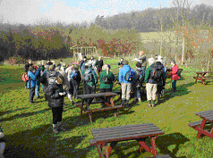
September in Swaledale…
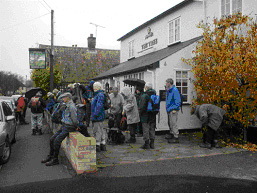
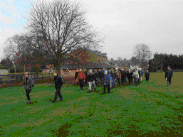
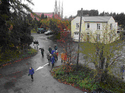
Ten ramblers, most from the Cambridge area, enjoyed a delightful midweek walking break in mid-September, led by David & Viv Elsom. They were accompanied by their indefatigable 12 year old sheepdog, Nell, always on the lead, and in the lead! We were based on the comfortable Kearton Country Hotel situated well up the dale at Thwaite, and ideally placed for walks at Kisdon Hill at the top of the dale, and for seeing the site of old lead-mines above Swinner Gill. David & Viv seem to know every track in this area, so following a tiny sheep-run above waterfalls led us (fairly) easily up steep terrain, whose photograph, when viewed later, made it seem impossible that we had reached the top!  Lower down the dale, Gunnerside and Muker offer shops, tea-rooms, and a museum for the less energetic. One day, we drove to Hawes, to spend an hour being seduced by bargains in the lively market, before walking over the moors to Bainbridge. Another day we drove to Reeth, to enjoy a walk along Fremington Edge, and take our picnic lunch near the village of Booze!

On a final half-day David organised a short circuit from the village of Marrick, while three of our number investigated the potential of the nearby golf course.

Measuring the walks as in the 12 mile bracket fails to take note of a salient feature of this delightful area.  Not only are there much-photographed stone barns scattered across the hillsides, the numerous small fields are divided by tall stone walls. Paths cross these by squeeze-stiles or stone step stiles. On one of the walks, we counted 86 of these picturesque impediments, surely equivalent to another couple of miles in the day, and needing a second helping of pudding in the evening to restore us!

Metal, Concrete, Wood or Plastic?
What am I talking about? Why, signposts, of course.

There has been a rather intriguing discussion on Ramblersnet prompted by John Andrews starting a discussion on the best mode of construction. He concludes:…

‘I have long had the feeling that different types of signposts have varying effects on the users of rights of way and on landowners.  Wooden ones seem, by their inconspicuous and often “wobbly” character, to be timid and self-effacing.  I imagine them wispering “Excuse me; sorry to bother you.  I hope you don’t mind me mentioning it, but did you realise there’s a footpath along here?” Path users rather worried about how much confidence to be taken from this somewhat uncertain proclamation; landowners scarcely pause for thought before elbowing them out of the way!

Concrete monsters, by contrast are over-bearing and town-crier like in their boasts. “You’d better believe this is a public right of way! Ignore me at your peril! Users a little overawed at their presumption.  Landowners, incensed at such arrogance, rush for the nearest JCB.

Perhaps the quietly confident green variety strike the right psychological chord. No doubt somebody will tell me …..’
John Andrews

Cantab Rambler by E-Mail & Post
A large number of you now receive Cantab by e-mail. By hand, 10p is appreciated towards the cost of paper and ink. If you would like to receive an issue by post, please send a large SAE, and a 10p stamp.

Offers of brief articles will be gratefully received.

This is a privately produced magazine, and the views expressed are solely those of the editor, or of the author of an individual item. Janet Moreton 01223 356889

e-mail roger.janet@care4free.net

Price 10 pence where sold
© Janet Moreton, 2003.

CANTAB20 September 2003

CANTAB20 September 2003 published on

** Please note that this is an archive of the CANTAB publication and contains out-of-date information **

CANTAB RAMBLER

A-roaming, A-roaming..
It has been flattering to receive several anxious enquiries this Summer as to whether recipients of Cantab Rambler have missed an edition! The answer is, “No, sorry”.  There have been no Cantabs since the May edition, as your editor has been away walking in Cumbria, Scotland, Austria, and more recently in Somerset, and catching up with work at home between trips.  However, here is the twentieth issue of this private magazine, which will continue to appear at intervals whilst the demand remains.

Whilst many of us from East Anglia prefer our holidays in hills or mountains, relishing the contrast of scenery, and the demands of hill-climbing, I can recommend Somerset for having both uplands and flat lands. The Levels are an interesting comparison with the fens, grass & cows replacing arable fields in the wetter climate, but with some good hill-climbing in the limestone Mendips, and sandstone Quantocks.  August and September finds the Quantocks glowing with heather and gorse in bloom, and dry footing everywhere.  In the more popular tourist locations, the paths were excellent, with good signposting and way-marking.  However, away from the “honey-pot” localities, signing of paths was sparse, and we found several overgrown stiles and hedge-gaps, to say nothing of a bridge with a large hole in the middle, and a right-of-way with a missing bridge.

Each evening on holiday, we took a few minutes to compile a list of problems with grid references from our new Explorer maps.  On reaching home, it did not then take too long to send 17 problems to Somerset County Council, as the responsible Highway Authority, with a copy to the Area Secretary of Somerset Ramblers’ Association.  The addresses are in the Ramblers’ Handbook.  Can I encourage you to do likewise with your holiday destinations? There is a strong feeling that County Councils take more notice of tourists’ complaints than those of residents, as being a source of revenue into the area.

Path Problems in Cambridgeshire
It is not only Somerset that has path problems: we can find plenty at home this Autumn.

Most of you will know that Roger and I are Ramblers’ Association Footpath Secretaries for the 100 parishes of South Cambridgeshire.  Generally, I regard the nitty-gritty of path problems to be rather dry fodder for Cantab which is designed to inform and entertain. However, in this issue, I seek to illustrate the repetitive problems we encounter, and ask for suggestions as to how long-term solutions might be obtained.  In Cambs, the problems are no longer generally those of missing bridges, or of statutory signposting where a path leaves a county road.  Path conditions are our problem – overgrowth in Summer; ploughed up paths in Winter. Here are some typical examples.

Fen Rivers Way
Duncan Mackay of the Fen Rivers Way working party, was embarrassed to receive a complaint from the North of England from a purchaser of the guide book. The walker had started in Cambridge but only got as far as just beyond Bottisham Lock to discover considerable overgrowth on the path. He had given up, and returned from Waterbeach, and never completed the walk. This complaint, one of many, occurs after similar complaints in Summer 2002, and  following promises from Cambridgeshire County Council that all would be well this year. We are told that one of the vegetation “cuts” was made during the dry weather of April, when there had not been much growth, and clearly only one more cut through the whole of the Summer was inadequate.

The section of the path in Norfolk is reported as being in good condition.  If Norfolk can do it, why not Cambs?

Councillor Complains of Sawston paths
While we were away, the Cambridge Evening News of 19 August published a letter from Councillor Sally Hatton of Sawston, complaining of nettles and overhanging vegetation on several Sawston paths. She wrote, “Very high nettles and overhanging branches need to be cleared from footpath 11, which runs between Church Lane and Babraham Road. Footpath 3, running between Hillside and Martindale Way needs to be cleared of overhanging branches etc, which in some cases, render it very difficult to negotiate the path.” The writer continues that these are only 2 examples of problems, which were reported to the County Council’s team 12 months ago, and still no action has been taken.

Whittlesford Moor
I wrote recently to Cambs.C.C. complaining of the state of Footpath 6 in Whittlesford. This attractive path passes through woodland, then follows two sides of a large arable field, which has been fallow for several seasons, and had a good trodden grassy path developed along the field edges.  This field has now been ploughed up, and the field-edge path with it, so that it is now actually dangerous to teter on the edge of a deep water-filled ditch, and laborious in the ploughland.  This type of problem happens regularly in the Autumn, and once the path is ploughed up, the surface is ruined at least for that Winter, and several seasons may elapse before the good surface can be re-established.

Yes, I received a reply.  The problem had been passed to the local representative in the “P3” (Parish Path Partnership) scheme.  The odds are, without badgering, I will never hear anything further, and the path will be in the same un-usable state all Winter.  However, at the foot of the letter was the standard line “Should you require any more information, then please don’t hesitate to contact me”.  So we e-mailed back our thanks, and asked for a monthly up-date!

Bourn Paths
In early August we were in Bourn, to find that the harvest was gathered in, and already fields had been ploughed, the stubble turned in and the field “cultivated” (i.e. reduced to a fine tilth, ready to receive the seed for the next season).  The law states that where a path crosses such a field, the line of the path should be “reinstated”, defined, and the surface made good within 24 hours.  (But after the first operation, the farmer has 2 weeks in which to reinstate).  Clearly, no reinstatement had occurred.   We complained to Cambs.C.C. on 6 August but by 1 September, had received no acknowledgement or reply.

This lack of reinstatement of cross-field paths happens all over the County. The Countryside Services Team send out letters of reminder to farmers in the Spring, and then tractor wheelings may appear, and the line of the path may be cut in the crop. But meanwhile the field path has been unmarked and often unusable all Winter.

If you, gentle reader, find problems, then try complaining to…
Cambridgeshire County Council,
Countryside Services Team,
Box ET 1009,
Shire Hall,
Cambridge, CB3 0AP

Tel 01223 717 445
cst@cambridgeshire.gov.uk

It is most valuable if possible to follow up path complaints by re-inspecting, and reminding.  Footpath Secretaries attempt to do this, but with over 200  cases on the books, the efforts per path become diluted.

Parish of the Month –
Abington Pigotts
Situated in the far SW of the county, the little village of Abington Pigotts is much closer to Royston, Herts, than to Cambridge. The population was 17 in the Domesday survey  rising to more than 200 in the nineteenth century, but is now only about 150.

The village is noted for its medieval moated sites, particularly Down Hall, along a lane to the SW of the village, with a moat, water-mill, and ancient gatehouse.  Radiocarbon analysis of the latter has given it a date-range 1250-1380. The gatehouse is jettied on two sides, and has two entrances, one for horseriders and one for foot-travellers. The bell-topped lantern is said to have acted as a guide for travellers across the moor.  Down Hall Manor was in existence before the Conquest, in the hands of Alwyn, The King’s Crier.  In the middle of the village is the pub, now called “The Pig & Abbot” (formerly “Derby & Joan”). The name changed when a village consortium bought the property, to save it from closure: the food is recommended.

There are 11 rights of way in the parish, giving reasonable access to Shingay, Steeple Morden and Litlington, but only laboriously directly to Bassingbourn across 5 arable fields (using Footpath 7, which starts up a field entrance  between gardens, almost opposite the pub). Try this after harvest, or in Spring when the crops are short, or when the ground is frozen hard! Local soil is boulder clay, or chalk overlying clay.

Footpath No.8 leads from 62 High Street, at the road corner, down the gravel drive in front of the house and continuing SW as a grass path with wood to right and arable to left. By the corner of the wood, “Bibles Grove”, we pass out of the parish, but a good all-weather gravel track continues SW between fields to Steeple Morden.

For a very short circuit, turn off left at the corner of Bibles Grove, TL 301 440, and join the gravel track, bridleway 1, running towards Down Hall Farm, where the famous gatehouse may be inspected. From here, turn left (NE) to walk up the lane, passing a wood pleasant with primroses in Spring, and thence return to the village.

Down Hall GatewayThree longer options are possible from Down Hall Gateway.

Option (a): turn right, (S) towards the mill buildings, then turn SE over Cheney Water Mill Stream on a wide brick bridge  and go through the wooded garden of the Mill Cottage, on Footpath 5, finally emerging over a shallow ditch into an arable field, TL 305 436. The continuing cross-field path in Litlington parish is often reinstated, and nearby paths through Manor Farm, Litlington lead to the centre of that village.

Option (b): continue past Mill Cottage on a grassy footpath (No.4) with Cheney Water to left. Follow this to TL 292 437 where a bridge spans the stream. Either cross the bridge and turn left for a good network of paths to Litlington or Steeple Morden, Or stay on the path to TL 296 435, where leave the field edge turning right across a narrow strip of arable field to join the firm bridleway to Bogs Gap, Steeple Morden.  This route is reasonable in Winter, since  the cross-field section is minimal.

Option (c): continue on Footpath 4, but turn off left on Footpath 6 at TL 302 435, crossing Cheney Water by a farm bridge. The RoW follows a mown grassy track with hedge & trees to right, arable field to left, to a waymark post at TL 302 434 by the field-corner where it turns SW to continue as Steeple Morden Footpath 22 across an arable field. (This option is not recommended in Winter, as the last field is very sticky!). Note that Footpath 6 was diverted in 1987, so older maps are incorrect.

Footpaths 2 & 3, leading to the N end of Steeple Morden, via Mill Hill, TL 301 440 need careful map reading, and involve some arable fields.

Footpath 2 turns off NW just beyond Bibles Grove, TL 301 440 on a track to Mill Hill. It turns left, right, and left again, sparsely waymarked, to the end of a hedge, TL 295 443, from whence it continues SW along a 2m wide earth track between open arable fields, crossing a bridge  to continue in Steeple Morden, and emerge nearly opposite the grassy access lane to the new Woodland Trust Woods.  There is a seat in the plantation – you might need to sit down after a couple of heavy fields!  (At TL 295 443, Footpath 3 turns off right from Footpath 2, NW across the arable field, leading to a path which crosses paddocks, and emerges through the garden of a house on the corner of Flecks Lane.. )

Back in Abington Pigotts, follow the lane to the church, which  has a porch dating from 1382. Bridleway 9 continues North  beyond, as a pleasant wooded lane, muddy in Winter.  Bridleway 10 is clearly signed, turning off left, and leading to Flecks Lane. This path is often heavily poached by horses. On Flecks Lane turn right, soon picking up a path on the right leading to Running Ditch, and thence to Shingay.  A quiet narrow road leading SE will bring the walker to the signed turning for Footpath 11, first as a clear track across an arable field, then briefly along a field edge, before becoming a charming narrow trail through trees, and rejoining bridleway 9, making a circuit of ca. 3 miles from  the church.

Points to Ponder…
Footpath News, Issue 25, April 2003 contains details of the largest estate in Britain with no rights of way.  John Andrews, RA footpath worker in Suffolk,  contends that this is the Shadwell Estate of 6000 acres, situated E of Thetford. It is owned by the royal house of Dubai, who breed racehorses there and also covers  breckland and woodland.  It seems that the pathless situation may be due to change with imminent publication by Norfolk County Council of Modification Orders for 2 byways, one of which connects with the Peddars Way. Access land claimed under the CROW Act may cause dispute..

Footpath News, Issue 30, Aug. 2003 reports on research into the economic value of walking, in a project on the value to the economy of England’s paths and access land.

Preliminary findings suggest –

  • £5.78 billion is spent by walkers in the  countryside;
  • between £1.4 billion and £2.6 billion income is generated by walkers.

Translated into employment statistics, walking supports up to 231,360 full-time jobs.
I’m not sure how these figures were derived, but it sounds very impressive.  How much do you spend on a day out walking?

  • Cost of transport (train fare or petrol);
  • Lunch out, or just a drink or ice-cream;
  • Maps and guide book;
  • Sun lotion, sting relief etc
  • Wear & tear on equipment – I reckon it costs 20 pence every time I wear my boots!

RoSPA (Royal Society for the Prevention of Accidents), in its annual report, gave the following figures for walking-specific injuries.

  • 1300 reported accidents were caused by stiles, and 2600 accidents attributed to barbed wire. Although barbed wire should not be found at access points on rights of way, much remains, or the nails from which the wire has been removed…

Cambridge Group in Cumbria
In early May, 11 walkers (some part-time) joined the RA Cambridge Group to Bassenthwaite for its sixth visit to Kiln Hill Barn.  Once again, we enjoyed the  hospitality of Ken & Heather Armstrong in the comfort of their lovely old farmhouse.

On the first day, 8 of us did a circuit from Greenhead, climbing the steep grass slopes of Yard Steel, and visiting Great & Little Scar Fell, some taking a deviationary route fording a stream, before re-uniting for tea at Uldale.

The second walk took us from Honister to Seatoller, over Dale Head, High Spy & Maiden Moor, a splendid ridge walk.

Day 3 took us to Buttermere, and up Haystacks via Scarth Gap. The next day was wet at first, so a lower woodland walk was planned from Whinlatter, through woods and by the shore of Bassenthwaite Lake back to the farm, only to prove the hottest day of the week!  We had more typical damp weather for the last two days – just four souls and Nell, the dog, braved the rain for a circuit from Howtown onto Red Knott, while the wiser shopped in Keswick. The last day was memorable not just for the rain, but for blustery winds, which made the ascent of the modest Knott Rigg up Newlands Pass quite exciting, but we were finally rewarded for our persistance with acres of bluebells in Rannerdale in sunshine.

This was the sixth group trip to Bassenthwaite, and we think the last, having led some 36 walks without repetition, or travelling too far.. Thank you to all those who have joined us over this period – the time has come to seek a new venue, when we hope you will come with us again.
Janet & Roger

Cantab Rambler by E-Mail & Post
A large number of you now receive Cantab by e-mail. By hand, 10p is appreciated towards the cost of paper and ink. If you would like to receive an issue by post, please send a large SAE, and a 10p stamp.

Offers of brief articles will be gratefully received.

This is a privately produced magazine, and the views expressed are solely those of the editor, or of the author of an individual item. Janet Moreton 01223 356889

e-mail roger.janet@care4free.net

Price 10 pence where sold © Janet Moreton, 2003.

CANTAB19 May 2003

CANTAB19 May 2003 published on

** Please note that this is an archive of the CANTAB publication and contains out-of-date information **

CANTAB RAMBLER

Rambling round Norfolk…
This year, The Cambridge Rambling Club had the bold idea of a YHA weekend in Norfolk at the end of January.  Jill Tuffnell organised a very pleasant break, staying at Wells-next-the-Sea, in a new hostel, splendidly converted from a former school, and open in Winter only for pre-booked parties…Good walking was enjoyed by all, both on the coast, and inland on the mostly sandy paths, providing a pleasant escape from the sticky boulder clay of Winter Cambridgeshire.  But we were lucky – one weekend later, and we would have been caught in snowstorms!

Roger & I so enjoyed this trip that we visited the North Norfolk coast again in March, this time staying in a guest house in Weybourne, for as little as £15 per night.  Again, the walking was excellent, with better signposting and waywarking than I remembered from a few years previously.
I would give two tips to other ramblers.  Many villages have display boards showing “Community paths, and other Rights of Way”.  I am not sure of the subtle differences in Norfolk’s classifications, but it is worth annotating your maps, because there appear to be both diversions and additions, some not shown on the recent Explorer sheets, and certainly not on the older Pathfinder series.

The other relates to FOOD.  Norfolk’s tourist industry does not come alive mid-week until Easter, so take food and drink with you for mid-day.  The pub you seek may have closed, and the cafe may say, irritatingly, “Open at the weekend”, and this in the presence of coveys of birdwatchers!
These breaks have inspired a Norfolk issue of Cantab, and I am very grateful to John Capes, long active in the Cambridgeshire rambling scene, for recalling for us his childhood in Norfolk, and conjuring up its atmosphere, in his delightful article on Paston.

Janet Moreton

North Norfolk Notes

Peddars Way
Ask a rambler where they have walked in Norfolk, and the odds are the response will be, “The Peddars Way, and Norfolk Coast Path”.  The National Trail has recently been decorated with sculptures. One is invited to “look at the sculptures carefully, to find hidden images that link with the book, A Norfolk Songline”. Book & CD by Hugh Lupton & Liz McGowan, from Hickathrift Books, 8 Church Terrace, Aylesham, NR11 6EU. Tel 01263 515900.

Fen Rivers Way
No reader of Cantab can be unaware of the Fen Rivers Way LDP following the Cam & Great Ouse from Cambridge to Kings Lynn. The guidebook, now in a third edition, is available from Cambridge RA Group, tel. 01223 560033

Nar Valley Way
Norfolk CC produce an A2 folded sheet for the Nar Valley Way LDP, which we walked in mid-Winter 2000.  We followed the waymarked route some 30 miles from Kings Lynn to its source near Gressinghall, visiting ancient sites at Wormgay, Pentney Abbey, Narborough, West Acre & Castle Acre, and the old round-towered churches of E. & W. Lexham, overnighting in warm guesthouses.

Weavers Way
This interesting 56 mile LDP runs from Cromer to Great Yarmouth, taking in an attractive disused railway line along its middle section.  Norfolk CC (Planning Office) at Martineau Lane, Norwich, made an attractive A2 folded route sheet available since 1999.  The route is now also illustrated on OS Explorer sheets.

Inspiration for Day Circuits
For those who want circular walks for a long day out, we have found inspiration in “Norfolk Heritage Walks” publ. 2000 by Norfolk RA, £2.10.  We extended their Walk 7, Sheringham Two Priories, Beeston, and Weybourne, to enjoy an excellent day, following precise notes.

Mel Birch’s “Historic Walks in Norfolk” (publ. Images, 1988) may no longer be in print, but has the right blend of instructions and historical notes. We particularly enjoyed a walk visiting Baconsthorpe Castle, near Holt.  A display board at the site also describes an 8 mile circuit.

Finally, we would endorse John Capes’ choice of the OS Pathfinder Guide for Norfolk & Suffolk.

JM

Letters to the Editor…
Dear Editor,

Highest Point in Cambridgeshire
Last year there was some controversy in the Cambridge Evening News after it was claimed that Castle Camps was the highest village in Cambridgeshire, with several people writing to the editor to point out that this was not true. I had known for several years that the highest point in the county was in Great Chishill, but did not know precisely where.

So I contacted the Ordnance Survey to find out the exact height and location. At first their Information Section said 142 metres, but after I pointed out that there were 145 metre contours on the maps they consulted their Survey Section and eventually sent me a letter and map pin-pointing the height as 146.3 metres at Grid Reference TL 42738 38546.

This places it in the centre of the B1039 opposite a row of houses about 150 metres south-east of the entrance to the recreation ground. Note that the Grid Ref of 427 380 given in the March Cantab Rambler appears to be below the 145 metre contour shown on Explorer 194 (Hertford and Bishop’s Stortford).

Yours sincerely
John Capes
Sawston, 30 March 2003

Editor’s Note.
Many thanks John, for exact information.  The data in the article on Chishill in the March 2003 issue of Cantab was obtained from Paddy Dillon’s “The County Tops of the British Isles”, publ. by Gastons-West-Col, 1985. p.23, which gives 146m (480ft). Clearly, some more precise surveying has been made recently.

The West Anglian Way
Many thanks for the Cantab Rambler. I enjoyed reading it.  You ask whether your readers would prefer an outline leaflet with basic instructions or a more elaborate booklet.

Personally, I would like both!! If the basic leaflet would be the descriptions of the walks which you already have on computer, maybe this would be pretty simple to produce.

I think a more elaborate booklet would be great. The Fen Rivers Way one seemed to be very popular. I would certainly buy one and I’m sure others would too. I really like the series of Cambridge walks booklets and dip into them all from time to time. I like walking books almost as much as maps!

I do keep walking guidebooks on a special shelf and revisit walks or parts of walks I have done and enjoyed and I just enjoy planning where I might go sometime. I also have quite a number of walking guidebooks of places I have never visited but would like to one day – such as Offas Dyke.

I am quite “addicted” to long distance paths and last week did another small section of the Icknield Way – from Hitchin to Baldock. Not the most inspiring of routes, but it took me that much further along the Icknield Way and I heard my first chiff-chaff this year, so that was very much worthwhile.    Happy walking,

Lisa Woodburn
Cambridge, 25 March 2003

And on a postcard…
Thank you for organising the West Anglian Way walks.  I can honestly say that I enjoyed every one of them.  It was so interesting to meet, talk and walk with people from other groups. Also I managed to use the train on all except one of the walks.

Best Wishes, Barbara Beston
Sawbridgeworth, 11 March 2003

Glad you could come, Barbara, and your thanks go to the  several people were involved in the arrangements. 

Regarding the guide, progress so far is a draft route description for all parts of the full walks. We would like to compile some additional notes for those who would like shorter sections.

Paston and Norfolk
by John Capes
It is now 40 years since I left the village of Paston in north-east Norfolk where I was brought up, but I still remember all the houses, fields, tracks and hedgerows that make up that small rural community.

I was actually born in my grandparents’ bungalow in the next village of Knapton, and then lived for my first year in another neighbouring village of Edingthorpe, but it is Paston that I regard as my ‘home’ village.  It is a very small village, in my youth there were about 300 inhabitants, it is probably much the same now – not much has changed there in the last seventy years, when I was last there two years ago only one new house had been built since I left!  It lies about half a mile inland from the coast between Mundesley (to the north) and Bacton.

The village is arranged mainly around a rough rectangle of roads, a mixture of council houses and ex-farm-workers cottages. There was a shop and post-office at one corner, but that is now closed.  From one corner of the rectangle is a loop road on which stood the vicarage, now a private house, and two other larger houses. There are several small groups of properties scattered around on the roads leading out of the village, one such group being about two miles away, nearly to North Walsham. There were three farms in the village, now reduced to two. There used to be a  village pub, The Wherry, but it was over 2 miles from the village centre on the North Walsham and Dilham Canal, also long since defunct. There was a builder’s yard and a blacksmith’s forge. The builder has gone, but a couple of years ago the forge was in use again by someone doing wrought-iron work. The school that served the village stood just in the neighbouring village of Edingthorpe, just over a mile from the centre of both villages.

There are three buildings of note in the village.  The rather nice thatched church is dedicated to St Margaret, which contains some tombs of the Paston family, but the main things of note are two mediaeval wall-paintings; one a ‘Doom’ painting – the three living and the three dead, the other of St Christopher.  But the church is rather over-shadowed by the magnificent 16th century thatched barn just across a farmyard. This was built by Sir William Paston in 1581 and has some really splendid roof timbers, with alternate crossbeams and hammer beams.  It is one of the three great barns of East Norfolk; the others being at Waxham and Hales, the latter is the largest and I think the earliest as it dates to the 15th century. The Paston barn is often quoted as a tithe barn, but it never was.  In the Eastern Daily Press of 15th September 1925 there was a report of a visit to the village in that year of the Norfolk and Norwich Archaeological Society, which stated, “The old tithe barn was pulled down fifty years ago. The Elizabethan Barn was never called the tithe barn”.

Then there is the windmill, sitting proudly on Stow Hill on the road to Mundesley.  It is often captioned in photographs as Mundesley windmill, but it is just within the Paston boundary.  It was built in the early 1820s; it last milled in about 1930, and the mill-stones were then removed; and was restored in 1961.

Mention Paston and a lot of people think of the famous Paston Letters, but these were not really about the village.  They were written by members of the family, over some three generations in the 15th century, and sent mainly from their other properties at Oxnead, Caister, Norwich and London.  The letters are considered to be one of the best records of the private social life of the period.

So there is the village, but what of the local landscape, and for ramblers the rights of way? The parish has always been very agricultural, and as a youngster growing up there in the 1930s, I and most of the other village children, roamed the fields fairly freely, as long as we didn’t spoil the crops, but we knew where we could go at the different times of the year.  The landscape is gently undulating, as is much of Norfolk. The flat parts are mainly at the eastern and western extremities; the Fens being near King’s Lynn and the Broads and marshes near Great Yarmouth.

Our explorations often involved going to see what the farm-workers were doing in the fields and thus we got to know just about every twist and turn of the various fields around the village. Although we could more or less go at will we often used the tracks and paths, but actually there were not many of these.  We had a vague idea that some of these were for public use and others not, but it didn’t really matter as everybody in the village seemed to use all of them.

There were four tracks leading to the cliffs, the one nearest to Bacton was well used because it led to the only easy way down the cliffs to the beach, but it was not a public track. It made the start of a very pleasant cliff walk towards Mundesley, but this track is now under the Bacton Natural Gas Terminal. The very lovely hedge-lined lane from near the vicarage was public with a footpath to the cliffs from its end, but unfortunately it was destroyed in the late 1930s to make the fields larger and more suitable for modern machinery!  However, it has remained a public path.  Towards Mundesley was another (private) farm track, but I used it a lot.  Then lastly from opposite the windmill was the Yarmouth Road.  Even in the 1930s this stopped at the cliffs, but in times past it had been the main coast road to Great Yarmouth, so it was public (it shows as a ‘white road’ on OS maps). This latter track led to Mundesley Holiday Camp – in Paston of course! The holiday camp caused a bit of a furore in the 1960s when they put a gate across it, but my father, who was chairman of the Parish Council at the time, soon got to grips with that and the gate was removed.

There are no footpaths near the village centre – there was one but that was closed when a new stretch of road was built in 1936.  Some distance from the centre are two cross-field paths one from the North Walsham road across to Knapton, the other to Edingthorpe Church.  However, at the far end of the village, towards North Walsham, there are several paths and two RUPPs (the latter may by now be re-classified).  There is now a marked route known as The Paston Way, which runs from North Walsham to Cromer and is shown on OS Explorer 252 (25).

What of the general walking scene in Norfolk?  I suppose that a disadvantage for many people is that it is agricultural, and with no hills of note. For me this does not matter, having been brought up in an agricultural village I am always interested to see what the farmers are doing.  Paths obstructed by crops can be problem, but in our walks in Norfolk during the past three years Tessa and I have found stiles are the main cause for concern: we found a particularly hazardous one near Oxborough recently.

Where to walk?  The coast is always attractive, there is a good one from Cromer along the cliffs to Sheringham, with a tremendous view of the latter from Beeston Bump; the return is then along the high ground just inland near the highest point in the county at Beacon Hill (102metres).

A few years ago I was given the Norfolk and Suffolk Pathfinder Guide book of walks and Tessa and I have done 27½ of the 28 walks in it (the half left over is in Suffolk). This has a very good range of walks. One that stands out starts from Holkham and involves walking along the beach, and goes through Burnham Thorpe – the birthplace of Horatio Nelson – and The Hero at Burnham Overy Staithe does a very good crab salad!  If you want something different walk across the Halvergate marshes to the Berney Arms pub by the River Yare – must be the most remote pub in the county, it’s only open in the summer to cater for the river trade, the only road access is by a dirt track; or you can walk to it along the bank of Breydon Water from Great Yarmouth.  If you fancy another unusual pub, walk from Blickling Hall round to the Walpole Arms at Itteringham. Another walk we liked was from Castle Acre along part the Nar Valley Way.

What about things to see on walks?  An outstanding feature of Norfolk is its churches, many of which are worth investigating.  That of St Peter and St Paul at Knapton, where I was baptised, has a wonderful array of angels adorning the roof timbers, reckoned as one of the best in the whole country, but in Norfolk those at Cawston and Salle rival it.  At Trunch, next door to Knapton, there is a most splendid carved font canopy.  To see some superb flint work look at the porch of St Mary’s at Pulham St Mary near Diss. Then there is the famous painted screen at Ranworth.  One special feature of Norfolk church architecture are the round towers, there about 150 in the county, easily more that the rest of the country put together – Suffolk has about 60, Essex just six, and of course Cambridgshire has only two – Bartlow and Snailwell.  Why are they round?  One story is that there no corners in which the Devil can hide; but the real reason is much more practical; Norfolk has no building stone and corners cannot be built from flint!

Norfolk is under-rated as an area for walkers, go there, and enjoy it.

JMC

The Paston Letters: a selection in modern spelling, edited by N.Davis, World’s Classics Edition, OUP, 1961.

The Paston Way: 14pp A5 booklet, first published by Norfolk C.C. in 1997.

Norfolk & Suffolk Walks  – Pathfinder Guide  First Published 1991 by Ordnance Survey & Jarrold Publishing.

Cantab Rambler by E-Mail & Post
Cantab usually appears every two months. A large number of you now receive Cantab by e-mail. By hand, 10p is appreciated towards the cost of paper and ink. If you would like to receive an issue by post, please send a large SAE, and a 10p stamp.

Offers of brief articles will be gratefully received.

This is a privately produced magazine, and the views expressed are solely those of the editor, or of the author of an individual item. Janet Moreton 01223 356889

e-mail roger.janet@care4free.net

Price 10 pence where sold
© Janet Moreton, 2003.

CANTAB18 March 2003

CANTAB18 March 2003 published on

** Please note that this is an archive of the CANTAB publication and contains out-of-date information **

CANTAB RAMBLER

West Anglian WayWest Anglian WayNov. 2002 – Feb. 2003

A heron motif is featured on the West Anglian Way Certificate.

The finale of the six walks from Cambridge to Cheshunt was completed on 22 February, on a day which turned out fine and Spring-like after a misty start. Some 45 people walked from Broxbourne to Cheshunt, via Waltham Abbey, ably led by Mark Westley.

During a short lunch-time presentation, in the garden of The Coach & Horses Inn (illustrated left) some 19 walkers received certificates and congratulations for completing the whole 65 mile route. These comprised 9 Cambridgeshire members, 6 East Herts members, 2 from North Herts, and 2 from Royston.

Quite a large proportion of the walk was in Essex where relatively few problems were encountered. However, on the penultimate section, walkers needed to bypass a barbed wire fence obstruction to Footpath 78 across North Cannons golf course at Roydon Mead. Complaints have been passed to Essex County Council about this, the only serious obstruction.

Thanks to all who helped organise, and all who came on this popular joint Cambridge-East Herts Group event.

It is hoped that it will be possible to have The West Anglian Way marked on future Ordnance Survey sheets, and that a leaflet or small booklet will be available in due course. It would be helpful to have feedback on preferred content: an outline leaflet of the route with basic instructions produced cheaply, or a more elaborate booklet with points of interest, illustrations and maps?  As a general point, do users keep walking guidebooks they have used as souvenirs of the route(s), maybe annotated with notes, with a possibility of repeating the traverse, or leading others along it?  Or when a route is completed, is the rain-stained guidebook passed to a friend or consigned to oblivion in the recycling tray?

And how many of the folk present are “addicted” to long distance paths, and veterans of The Icknield Way, The South Downs Way  etc?  Was there anyone for whom this was their first long distance route?


The Meridian Stone near Waltham Abbey.
Photos courtesy Mark Westley.


Parish of the Month –
Great & Little Chishill, South Cambridgeshire.

Landranger 154;  Explorers 209, 194; Pathfinders 1027, 1050

Scenically, geographically, and historically, this parish is amongst the most notable in South Cambridgeshire District, and well worth a prolonged visit.

History of Chishill *(1, 2)
The parishes of Great & Little Chishill were amalgamated into one in 1967, and together cover 1300 hectares, lying across a steep chalk escarpment, rising from 40m at the A505, to a high point of 146m. The open village fields were enclosed in 1818.  In Domesday Book, the name is given as Chishelle, meaning “gravel hill”, and referring to patches of gravel overlying the chalk in higher places. The parish was part of Essex until 1895, when together with Heydon, it was transferred to Cambridgeshire.*(2) The Icknield Way (IW) routes passing through the parish were already important in the Neolithic and Bronze ages, with at least 40 ring-ditches known from the air.  The IW continued in use as a long distance path (LDP) in the Middle Ages, and strip lynchets survive from medieval ploughing on Chishill Down, TL 423 400.  Contemporary use still takes the Icknield Way LDP through Chishill on the old trackway. Great Chishill’s C15th church (with a modern tower) stands on a prominent mound at the village cross-roads. Little Chishill Church stands beside what is now only a hamlet, and is best reached on foot from Great Chishill via the byway running S from May Street at TL 420 384.
 After cresting the hill, the track becomes a sunken lane, descending past the gardens of Little Chishill Manor, to emerge on the Little Chishill road at TL 419 374, almost opposite the church.  A public footpath crosses Little Chishill churchyard and exits between trees over a stile in the rear fence. The right of way crosses a grass field to a stile in a crossing fence, and continues W, across an arable field to a wooden bridge at the county boundary spanning “Water Lane”. A continuing path leads to Shaftenoe End, Herts, whence a return may be made to Chishill via the minor road.(3.5 miles).

Cambridgeshire’s highest point,
146m (480ft) is situated near the county boundary at Great Chishill at TL 427 380, about 400m S of the B1039, where a grassy triangle marks the driveway leading to The Hall (rather hidden in trees).
 From here, a bridleway runs across the arable field towards Building End. Continuing, a good 11 mile walk (*3) can be had via tracks and paths to Langley Church, Duddenhoe End, Chiswick Hall, the isolated Chrishall Church, Chrishall village, and along the line of the Icknield Way Long Distance Path back to Chishill village. Parking for this walk, however, is better in the village itself, where there is a small car park near the telephone box, TL 423 388, close to The Pheasant Inn.

Great Chishill Windmill
Also of interest is the attractive preserved postmill, sited at TL 413 388 outside the village on the B1039 towards Barley. This mill, which last worked in 1951,  was rebuilt in 1819, using timbers from an earlier mill of 1726. The modern restoration has left the sails without shutters and a rather odd skeleton of a fan has been provided. The  mill is, however, complete internally, having 2 pairs of stones, and all-wood gearing except for a cast-iron windshaft (*4). Keys may be obtained from houses in the village.  The mill is maintained by Cambs.C.C., who provide a display board, a small car-park and picnic area. A well-maintained public footpath leads from behind the adjacent garden towards Chishill village centre.  At the crossroads stands the village sign illustrating the mill.

The Parish Pit
Leave the village cross-roads NE, and shortly turn NW down New Road. At TL 423 392, a green metal sign in the hedge indicates a track between gardens, then round a field edge to enter the old parish clunch pit, which is maintained as a nature reserve.

The public footpath through the pit runs generally NE, as a narrow earth track between rampant vegetation to emerge on another footpath at a T-junction, TL 425 393. From here, turn right (uphill) on a narrow path between a stream and hedge, to return to the village. This footpath exits at TL 426 391 onto Heydon Road, Great Chishill, a short walk from the crossroads.

Alternatively, for a longer walk of 4 miles, turn left (downhill). The path at first is a narrow defile, with the trees of the former clunch pit to left, and a stream to right.  Soon, the path opens to fields on the left, with wide views over the Cam Valley. It continues to  New Buildings Farm, then still NW to join the ancient Icknield Way track, by a signpost at TL 410 418.  Turn right along this green lane, between intermittent hedges. The byway along the line of the ancient Icknield Way trackway continues in the parish of Heydon, reaching a marker post at TL 412 420, near a copse. Turn right uphill, now following the line of the Heydon Ditch (an early Anglo-Saxon fortification). At first this is a raised grassy baulk between arable fields.  As it climbs the hill, it becomes a hedged path, later between high banks, and finally emerges between gardens by a footpath signpost with Icknield Way markers on Fowlmere Road, Heydon, at TL 431 405.  Walk S up the footway towards Heydon Church (bombed in 1940, observe the brick restoration) then turn right along the road, passing the King William IV Inn, and the Wood Green Animal Shelter.The former provides food, and visitors & donations are welcome at the latter!

* (1) Archaeology of Cambridgeshire. Vol.1 South West Cambridgeshire by Alison Taylor.  Publ. Cambs.C.C.1997, pp.29 – 30.

* (2) An Atlas of Cambridgeshire and Huntingdonshire History. Ed. T.Kirby, S. Oosthuizen, Publ.Anglia Polytechnic Univ. 2000.

* (3)Full description – walks in South Cambridgeshire, 2nd. Ed. 1993.Walk 13.  Publ. Cambridge RA Group.

* (4)Batsford Guide to the Industrial Archaeology of East Anglia, by D.Alderton & J.Booker, 1980, pp. 43 -44.

Changes to the Definitive Map in Cambridgeshire
The following information is extracted from Cambs.C.C. Annual Report of Changes to the Definitive Map, as made by Legal Order in the year 1 April 2001 to 31 March 2002.  Some of the new paths have been available on the ground for some time already.

Because of Ordnance Survey copyright restrictions, we are not able to reproduce any maps here, but the following  grid references will allow readers to annotate their maps.

Whittlesey Bridleways 59, 60, 61
Paths near railway: grid refs. TL 291965 to TL 298 966
A section of Fp 41 has been upgraded to Br 59, & a section of Fp 48 upgraded to Br 60.
The bridleways were created by agreement with landowners, Sustrans Ltd., and by upgrading 2 sections of footpath, total length ca. 650m, forming part of a National Cycle Route.

March Footpath 10
Part of footpath 10 between Camargue Drive and Cavalry Park was extinguished as part of housing development.  Grid refs TL 417 955 to TL 417 956.

Grantchester Footpath 12 (part)
A path was created alongside the M11, near its junction with the Barton Road, A603, opposite Haggis Farm.  Grid refs TL 417 562 to TL 420 561.  The footpath was created by Cambs.C.C, by agreement with landowners.

Fenstanton Bridleways 16,17,18,19
Rights of Way have been added to connect two existing subways under the A14.  Grid refs TL 314 684 , TL 317 681

Dry Drayton Footpaths 17, 19
Footpath 17 from behind the church has been re-aligned to follow field boundaries, mostly beside a little stream. Footpath 19 is a new path created by agreement with landowners, to join a point along Fp 17 to Scotland Road, almost opposite Br 18.  Grid refs TL 374 612 to TL 379 613

Willingham Bridleway 12
A new bridleway was created by agreement with landowners, Hanson Quarry Products, running ca 2.9km from West Fen Road, Willingham to No 18 Drove, S of Earith.  It runs roughly parallel to the B1050 ,  generally one field width from the road.  Grid refs. TL 392 745 to TL 395 729

Swaffham Prior Footpath 6
A short section of this path near Pulpit Corner, was diverted by East Cambs.D.C. to Heath Road, as part of a housing development.  Grid refs. TL 374 612 to TL 379 613

Wicken Footpath 28
A short path from Wicken High Street to Back Lane was extinguished, as it appeared to the Authority (East Cambs.D.C.) that it was not needed for public use. (Redit Lane goes through between the two roads a short distance away).  Grid ref TL 568 707

Holywell cum Needingworth Bridleways 17,18 and Footpath 19, and Bluntisham Bridleway 14
Bridleways of ca 1.9km length, and a footpath of ca. 1.3km were created by Cambs.C.C., by agreement with Hanson Quarry Products Ltd., and another landowner. Grid refs. TL 348727 to TL 357 715 (Br) and TL 363 719 (Fp)

(Part of) Ely Footpath 35
A section of Footpath 35, total length ca.65m, was extinguished by Cambs.C.C, as it appeared to the Authority that it was not needed for public use (now being an adopted highway by Jubillee Terrace, off Cutter Lane).  Grid refs. TL 543 798 to TL 544 798

Path News…
Great Chesterford Bridleway Bridge now reopened
Walkers on the Icknield Way were subject to a long detour for some weeks until after Christmas when the bridle bridge was closed over the M11 at TL 502 422, on the long path from Strethall Field to Great Chesterford.  The editor can confirm that the bridge and path are now reopened.  The bridge now has new high-level shuttering, designed to shield horses from the distracting view of the traffic on the M11.

Bourn Footpath 2
This long path runs from Caxton End at TL 317 576 to Broad Way at Great Common Farm, TL 335 593.  As anyone familiar with the locality can imagine, this once pleasant footpath has become entangled with the eastern edge of Cambourne.  Eventually, part of the path will run through a landscaped area and past a lake, then along what we hope will be a green corridor between further housing development. At present “brown” would be a better description than “green”(!), and the developers have proceded to dig out the lake, and block the route before seeking a formal diversion, or even consulting with user groups. A temporary diversion is now in place, only after a local user found “path closed” notices.

Caldecote Bridleway 3
This narrow bridleway, running east from the road at Highfields, TL 351 582, to join Bridleway 4 alongside Hardwick Wood, has for many years been almost unusable by walkers in Winter’s deep mud. The fenced path is defined as a mere 10 ft wide, and in practice is usually less, due to the adjacent hedge. Karen Champion, with Cambs C.C’s Countryside Services Team, reports that work on improving this route has recently been completed.

Fulbourn Footpath 15
The footpath following Caudle Ditch along the Teversham parish boundary to join Little Wilbraham River at TL 518 589 has long been subject to bushy overgrowth.  But Karen Champion of Cambs.C.C. now reports work by 40 servicemen from Waterbeach base have now cleared this valuable and attractive route.

Roger Moreton

Cantab Rambler by E-Mail & Post
Cantab usually appears every two months. A large number of you now receive Cantab by e-mail. By hand, 10p is appreciated towards the cost of paper and ink. If you would like to receive an issue by post, please send a large SAE, and a 10p stamp.

Offers of brief articles will be gratefully received.

This is a privately produced magazine, and the views expressed are solely those of the editor, or of the author of an individual item. Janet Moreton 01223 356889

e-mail roger.janet@care4free.net

Price 10 pence where sold © Janet Moreton, 2003

CANTAB17 January 2003

CANTAB17 January 2003 published on

** Please note that this is an archive of the CANTAB publication and contains out-of-date information **

CANTAB RAMBLER

West Anglian Way

Nov. 2002 – Feb. 2003
The first 3 walks of the West Anglian Way were a great success, and we look forward to three further walks to Cheshunt. Photographs taken on the walks by Mark Westley are reproduced with kind permission.

“The Tree” at Stapleford, 2 Nov. 2002
Ickleton Recreation Ground, 16 Nov. 2002
Whittlesford Station, 2 Nov. 2002


Parish of the Month – Elsworth,
South Cambridgeshire
Elsworth is situated between the A14 and the A428, some 13 miles West of Cambridge. The parish covers 1500 hectares of clay soil, except for an outcrop of limestone to the North of the village.  A height of 65m is reached along the ridgeway of the Cambridge to St Neots road, but the village itself is low lying, and several houses were flooded in 2001. The population was ca. 600 in 1996, but the village has grown modestly in the last few years. Parliamentary Inclosure took place in 1803.  A baker’s dozen of rights of way (including inner-village paths), are mostly in fair order, although in Winter the going is slow on the clay.

Join me for a short walk around the village, then choose a longer walk from those below.

I am starting from Broad End and using the footpath to cross the recreation ground diagonally, to emerge on Smith Street, opposite the Poachers Inn, now owned by the villagers, and welcoming to walkers.  Across the recreation ground to the left are some willow-fringed ponds, the remains of Manorial moats. The Manor House adjacent is on the site of Abbot de Ramsey’s medieval manor.

The village sign, at the junction of Brockley Road and Smith Street relates to village history, showing an ammonite, referring to the local rock outcrop, a shield bearing the arms of the Abbot of Ramsey, a cartwheel for village crafts, and a spray of wheat to symbolise local agriculture.

Go South down Brockley Road, passing The Poachers, and take the second turning on the left, called “Spigot Lane”, between pretty cottages.  This narrows to a footpath, and soon emerges onto Brook Street. Here turn right, following the raised footway beside the brook, with footbridges crossing at intervals.  Where Brook Street turns North, becoming Church Lane, note the signpost and stile for the footpath starting of Walk (A). For the present, continue up Church Lane, and visit the C14th parish church  which contains medieval wooden figures supporting the nave roof, and C15th carved stalls. Go through the churchyard, to emerge on the other side into The Drift, (start of Walk D).  A green metal footpath sign here indicates a fenced alley running behind gardens, round a right angle to meet Boxworth Road. Go down leafy Duncock Lane opposite. Part-way down, on the left, a couple of steps lead up to another fenced alley through to modern housing in Roger’s Close. You need to look carefully to see the next fenced right-of-way opposite leading through to Paddock Row. In the corner, a green metal sign, part-hidden by a hedge, indicates the path where you finish Walk (B). Follow the charming Fardells Lane, with primroses and violets growing at the edge of the woodland in due season. Note the old houses raised well above the lane, for the little brook running beside it floods in heavy rain.  Turn left at the end, and walk back, past the school to the starting point. The path commencing Walks (B) and (C) is signed starting up the fenced side of the school grounds.

Walking opportunities from Elsworth
Maps – Pathfinder 981; Explorer  225;  Landrangers 153, 154.
(A) Knapwell Take the fp S, joining the bp past Lawn Farm to the A428.  Go E along the verge to the roundabout, and take the fp N past Coldharbour to Knapwell. Visit the Church and nature reserve, and return on the fp starting half-way along Knapwell village street to The Drift at Elsworth. (8 miles).

(B) Hilton & Conington Take the fp from beside the school, towards Pitt Dene Farm, then the bp N to Hilton.  Visit village green, turf maze & church. Take the permissive fp from TL 300 660 along track E, then NE to road at TL 316 673, follow road to Conington, visiting The White Swan PH and Church, returning by fp S to Elsworth (8 miles).

(C) Hilton, The Papworths  Follow route (B) to Hilton.  With care, take the busy road S towards New Farm Cottages.  Use fp W to Ermine Street, then signed bp to Papworth St Agnes.  Note old bakehouse and  church with fine flintwork.  Find obscure start by garden, TL 268 643 to long path S to minor road at TL 271 624.  Cross St Ives Road, and take route across fields to Papworth Everard Church. Go down Church Lane to A1198, turn left on footway, and go right up Wood Lane bounding rec. Follow the signed route through new housing N to fp joining farmtrack on high land running  E back to Elsworth. (11 miles).   Note – route finding may be demanding!

(D) Knapwell, Childerley, Lolworth, Boxworth and Conington  From Elsworth take The Drift fp past the church to Knapwell. Take Thorofare Lane, turning S to visit Childerley, spying splendid old house and private chapel. Take bp N to Lolworth, and W to Boxworth, visiting the church, and The Golden Ball PH. Use the long bp NW to Conington, and fp S to Elsworth. (10 miles on good paths).

Magazines for Walkers
As regular subscribers to Cantab Rambler it is assumed that you are an audience that, as well as going walking, enjoys reading about it, and of associated countryside news. When recently gathering some magazines into a tidier heap, it became apparent that there is quite a range of these covering both the national and regional scenes.

Nearly all of you will know The Rambler, official organ of The Ramblers’ Association which appears four times a year.  We are familiar with the thoughtful articles on national issues, news, reports of local Ramblers taking action, listings of events, and articles encouraging the young, less able, underprivileged or minorities to join the RA. I find the letters generally interesting and the guidebook reviews trustworthy.

Country Walking appears monthly in newsagents at £2.95 for a 100 page magazine packed with information.  Many buy this particularly for the pull-out supplement with at least 25 walks per month, nation-wide. Most of these walks are on the shortish side (4 – 8 miles) for the serious walker, with a few up to 11 – 15 miles, but all recommend attractive walking areas, or a less busy approach to a well-frequented locality.  Like The Rambler here are kit reviews, and advice galore, the latter perhaps aimed more at the novice. Do you try the where am I walking competition at the back ? Twice entered, but no success yet!

The Great Outdoors is a similar monthly heavyweight, in terms of pages, but this one is directed at the tougher rambler, venturing on mountains, and  having  a greater emphasis on walking in exotic places.  It is in here that we read of Hamish Brown’s “top 20” Monros – and decided to substitute the criterion of “greatest character” to that of “maximum difficulty”!

More serious reading matter is provided by Footpath Worker, a quarterly bulletin, edited immaculately by Janet Davis of Ramblers’ Association Central Office, and aimed primarily at footpath workers (but available on subscription to other interested parties).  Here we may study complex issues of path orders at public inquiries, court cases,  cases dealt with by the Local Commissioner for Administration (Ombudsman), and sometimes accounts in dry tones of appalling mistreatment of paths, brought before the law.  You will find also local authority matters, government reports, and details of new publications, e.g. the British Standard Stile.

Equally serious and worthy is Open Space, the quarterly magazine of The Open Spaces Society.  (Copies are sold separately to non-members at £3).  Edited by Kate Ashbrook, this treats path issues in a more user-friendly format – with photographs, personalities, and a slightly less academic style.  Open Space deals with commons and access land, but is equally at home fighting for footpaths, bridleways and byways.

But what of the more local magazines? The venerable Southern Rambler covers what a boon the Van Hoogstraten case has been to editors!  One can imagine the commuter perusing his (or her) Southern Rambler instead of the London Evening Standard, although, alas, it does not appear so frequently!

Then we come to the Ramblers’ Association County A4 size bulletins, twice, thrice yearly or quarterly. Comparisons, they say, are odious, but here there is no comparison. “Stile” is edited by Justin Lumley for lucky Hertfordshire Ramblers; it runs to 16 sides, and is distributed to a very substantial membership.  It has everything, including adverts, which no doubt help to pay for its production.  Indeed, one remains puzzled that our Hertfordshire subscribers, already informed by Stile, bother with Cantab Rambler!

Finally, there are the journals of the Icknield Way Association, and that of The Friends of the Hertfordshire Way, designed to support a long distance path and to service far-flung members with information.  The Fen Rivers Way Association Journal produced a modest number of issues to inform and promote the path between Cambridge and Kings Lynn during its inception, and in the course of the sectional walk in 2001, and has now been merged with Cantab Rambler.

Slightly different in emphasis from the above is the fairly new “Friends of the Roman Road and Fleam Dyke”, which produces an intermittent newsletter, packed with historical and nature notes, as well as information on the state of these important Cambridgeshire ancient monuments and trackways. It costs just £5 to be a “friend” and receive a newletter from Julia Napier, Sec., 30a Hinton Ave., Cambridge CB17AS, Tel 01223 213152. Practical help with scrub clearance etc is welcomed but not obligatory!

Do we read all these, with their overlapping stories, and even borrowed articles, looking for variants in presentation or opinion, like a comparison of The Times and The Guardian? I suspect not – we just browse, looking for items of immediate interest.

But thank you for reading Cantab Rambler!

Track the paths on-line
Thanks to the work of Duncan Mackay of Cambridge RA Group’s Committee, there is now electronic access to The Ramblers’ Assoc. Cambridge Group’s Millennium survey of the paths of South Cambridgeshire.

Use   www.higharctic.co.uk/footpaths, and search for the information by parish.

Stepping back into history
If you think footpaths & bridleways are tediously muddy in Winter, it is always possible for a change to take a walk on the made-up paths in a park, or round the town.  Imagine a time when nearly all roads were unsurfaced, and women wore ankle-length skirts to drag in the ubiquitous horse-muck!

I was recently delighted to be introduced to “Royston 1900: A year in the life of a small market town” by S & J Ralls,  published by The Royston & District Local History Society, 1999, and now reprinted. This book (A4 format, 208pp) includes items from the County Record Office, old photographs, and snippets taken from contemporary editions of The Royston Crow.  We are given a real insight into the lives of residents 100 years ago, and of conditions in this little market town on the Herts/Cambs border at a time when the motor car & the telephone were just appearing, the bicycle becoming popular, and excursions and nature study on Royston Heath becoming not simply a preserve of the leisured and educated classes.

The building now housing Royston Museum in 1900 (reproduced with permission, Royston and District Local History Society).


Copies are available by post at £10  from David Allard, 8 Chilcourt, Royston, Herts., SG8 9DD, inclusive of postage and packing. (cheques ifo RDLHS) or for £7.95 from Royston Cave Art & Bookshop, 8 Melbourn St., Royston; Royston Museum;  David’s Bookshop, 14 Eastcheap, Letchworth;  Ware Bookshop, 10 Baldock St., Ware;and Sawston Books, 6 Morley’s Place, High St, Sawston.


News of Friends…
Cambridgeshire ramblers will be sorry to learn that Professor Thurstan Shaw, octogenarian President of the Ramblers Association in Cambridgeshire has been unwell this year, with three spells in Addenbrookes’ Hospital.  He is now recuperating for the Winter in Shelford Lodge, 144 Cambridge Road, Great Shelford, and enjoys having news of walkers and their doings.  Thurstan has a world-wide reputation as an archaeologist, but ramblers know him best for his work in founding the Icknield Way Association, and in establishing the Icknield Way as a long distance path. It was his great satisfaction to see the Icknield Way established as a regional route, but his ambition is to see it become a National Trail.

Recuperating at home is Stan Hampton, following a heart bypass operation.  We enjoyed visiting him recently in his bungalow at Wyton, and found him his usual chirpy self. Some 10 weeks after the major op, he is driving again, and now in the “top class” of the physiotherapy sessions at Papworth.  Friends will join with me in sending good wishes, and we will look forward to seeing Stan, (former Treasurer of Cambs RA) on walks in the Spring.

Cambridge RA Group and The Rambling Club are sad to be losing Judy Stoneley, who, with her husband Tony is retiring to the Isle of Wight in 2003.  Judy has been a regular reporter of path problems to Cambs. C.C. Her major contribution to the Cambridge Group’s Millennium Survey of South Cambs, when she assisted the survey of no fewer than 251 paths in 2 years, will be valued in future by those who peruse the volumes of the report deposited at the County Records Office & in Cambridge City Library. Best wishes to both on your retirement and thanks for everything, Judy!

Cantab Rambler by E-Mail & Post
Cantab usually appears every two months. A large number of you now receive Cantab by e-mail. By hand, 10p is appreciated to cover the cost of paper and ink. If you would like to receive an issue by post, please send a large SAE, and a 10p stamp.

Offers of brief articles will be gratefully received.

This is a privately produced magazine, and the views expressed are solely those of the editor, or of the author of an individual item. Janet Moreton 01223 356889

e-mail roger.janet@care4free.net

Price 10 pence where sold
© Janet Moreton, 2003